
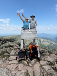
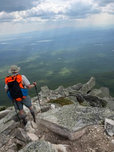
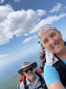
We finally made it to the summit of Katahdin on Monday, July 13th around 1:30 pm. It took us 6 hours to summit! It felt really good to make it to the top!
I’ll try to write about the 100 Mile Wilderness in another post. It was a beautiful hike. The biting flies were crazy……… hence the neck gaiter over my hair. Those evil creatures kept trying to “nest” in my hair and bite me. They can bite through hair and TWO layers of clothing! Again, I was asking God why he created these deer flies and WHY they made the cut on the ark. The homemade bug spray and the OLE purchased prior to the trip did NOT deter these creatures! We ended up getting Picaridin at Shaw’s. That’s a story for the post on the 100 Mile Wilderness, though.
We returned home the weekend of the 18th. I’ve been working hard to catch up at work for the past week, and coming back after two weeks is definitely a challenge. I’m starting off tomorrow feeling a bit behind again. But hey, it’ll be okay! I’m heading to South Carolina this week, Pennsylvania the next, and Ohio the following week. I’m planning to burn up the roads this next month. My new work car is on order and should be delivered sometime in July, which means by the end of August. <laughter> I’m looking forward to the new set of wheels. The new car will have a sunroof and is a hybrid. Sweet.
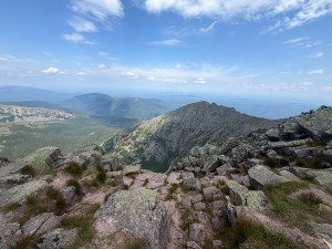
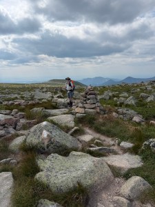
Once we made it from there 100 mile wilderness, we did a small resupply, which disqualifies you from being able to climb Katahdin from the Birches Campground 9 miles from Abol bridge. They have strict rules about who needs and doesn’t need a permit to climb the mountain. I needed new trekking poles and we had decided to get some tuna packets and crackers along with a few other snacks for summit day. We knew water would be scarce that day and we wanted food we could eat without rehydrating. We lightened our pack load. We carried water, water filter, our puffy jackets, rain jackets, first aid kit and food. We wanted to be prepared just in case something happened, but did lighten the load for the climb.
Maine residents get first dibs on the permits to climb Katahdin from any of the 5 trails that make it to the summit. Through hikers don’t need permits to climb – as long as you make it through the 100 mile wilderness without getting off trail AND hike into the Birches without getting off trail. Our original plan was to hike straight through to the Birches campground. Plans changed, so we had to figure out the permitting process. Which, to be honest, is confusing. We think the parking pass to park at the trailhead was the permit. It only cost $20 per car.
All out of state permits were already gone when we checked Sunday online. They are available beginning two weeks beforehand to Maine and out of state residents. This is the same timeline, no matter where you live. We stopped by the Baxter State Park Visitors Center in Millinocket on Sunday to see if they knew how many Maine permits were still available for Monday. The Ranger at the campground and the Rangers at the visitors center all felt we had a great chance of being able to summit Katahdin the next day. It appeared that there were at least 6-10 Maine resident permits that had not been used. They all told us to arrive EARLY. We were overjoyed to hear this news, but also had a few more days to get in line if it did not work out Monday.
We arrived at the gate of Baxter at 4:30 am. At 6am, the gates open and the rangers let folks with permits into the park. Non permit holders are placed into a line. We were number 3! We made it to the podium. Once 7am rolls around, if no Maine residents show up, these permits are given out on a first come, first served basis. We got one! Yay.
We got a later start than we had wanted. We had wanted to get on trail EARLY. I am not the fastest hiker, but I make it. I changed my trail name slightly after I bought a LiteAF fanny pack for snacks. Snacky Turtle. <smile>. Marty got his trail name about two days in. Daddy Longlegs. Why? Because there are huge rocks and giant steps to climb. I would ask, How did you get over this or that? He would say, “Step here, there, and right there.” I would tell him how my legs were not as long as his. And a trail name was born……..
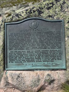
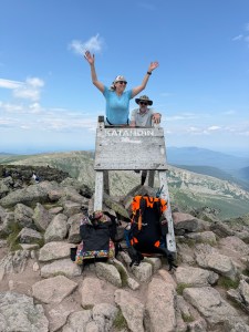
It was somewhat anticlimactic reaching the top, because I was expecting Katahdin to be much tougher than it turned out to be. It WAS definitely a tough climb with over 4000 feet of elevation gain, so don’t think it was an easy climb. It was NOT easy. I had just imagined that it would be almost impossible for me to climb, so when I reached the summit sign, I asked Marty, “Is this it?”
Here’s the big secret: make goals — even if you don’t think you can do it. You might surprise yourself! AND you are stronger than you think! Who would have thought that this is how I would start my 58th year of life!? With this beginning, I know that I am going to ROCK level 58! Don’t let the blog posts, articles and YouTube videos scare you into not making goals!
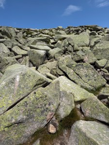
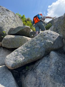
There are miles of rock scrambling up the mountain’s side. It feels like you have to climb straight up these rocks at times. Pictures don’t do the mountain justice; you have to climb it yourself to see its beauty. Trying to keep the trail markers in sight while looking for the best way to scramble over rocks can be a challenge at times. Luckily, we only had to back track once or twice!
A day or so before we came out of the 100 Mile wilderness, I broke one of my cheap Amazon acquired carbon fiber trekking poles. Marty let me use one of his to complete the journey, but the we reached Abol bridge campground and shuttled to get the car, we went into Millinocket. It’s a small town about 40 minutes from Baxter State Park that has a gear shop. I bought a set of Leki poles there. I am sure glad that I did. These Leki poles are much more stable than the Amazon poles I’ve been using the last two years. I also knew that Marty and I both needed two poles to make the trek up Katahdin. He had given me one of his to use saying, “You definitely need two poles more than I need two poles.” <laughter>
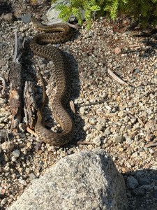
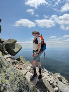
Below the tree line, it’s a completely different world than above the tree line. The whole mountain feels otherworldly! As you come above the tree line, you enter the rockslide area. Once you climb over the rockslide, you reach the tableland. The Tableland is fairly flat and rocky. From the tableland, you still have a bit of a climb to Baxter Peak. I think we walked about 1.5 miles on the tableland before reaching the peak of Katahdin.
As anyone who knows me knows, I’m terrified of heights. Going up was much easier than coming back down. While there were very few times I felt I was right on the edge, just seeing how far one could fall was a bit disconcerting for me. Luckily, the rain held off until we got back below the tree line. With just a few miles left on the trail, it poured rain. I have never been so thankful that rain held off in my life. I cannot imagine scrambling down the rock in a downpour. We did not stop to take photos on the way back down. We were trying to beat the rain AND had taken a number of photos on the way up. It took us 5 1/2 hours to get back down.
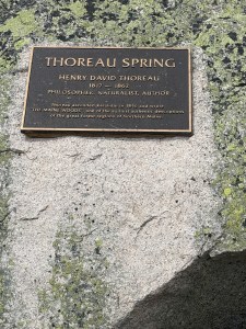
Last June (2025), a daughter and her father died on Katahdin. They found their bodies not far from Baxter Peak. The daughter had died from blunt force trauma and it is not known how the father died. I assume she fell? Katahdin is no joke, y’all. I think knowing that people have died trying to climb it added to my fear and doubts! Although, historic records say that only 64 people have died since they started keeping track of deaths on Katahdin in 1933. Thoureau climbed the mountain back in 1846. This is why the spring at the top is named after him.
If you climb, you need to make sure you have enough water. We did carry our filters, but water sources are limited. The spring at the top is not an abundant source. We did see a few places that we could have gotten water, if necessary, but we made sure to carry enough for the entire ascent and descent.
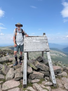
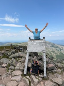
As we climbed on the sign, I think I was a little more excited than Marty. Ha ha. I’ll share the photo just before the photo and one of him afterward. I decided that I’m not a videographer, as well. I tried to get some videos, but learned that it’s very important that I keep my day job. It is really neat to see the wood with huge indentations on the back from the thousands of folks who have climbed on this sign to take photos.
Once we made it back down, we drove back into Millinocket to the Katahdin General Store. We bought premade food and the shirt that said, “I climbed Katahdin”. We lightened out packs that day and brought packs of tuna to eat so that we would not need water to rehydrate food on the climb. We knew water would be scarce. After sitting in the car for 40 minutes on the way to the store, it felt like our bodies seized up. <laughter> It took a few minutes to loosen up!
We made it to Bangor after 10 pm on Monday evening. Thanks to traveling for work so much, I am a Diamond Reserve member and get 4pm checkout. We bought epsom salt and laundry detergent. We spent Tuesday washing clothes and soaking in epsom salt. We left somewhere around 3pm Tuesday with clean clothes and made it to a $77 a night AirBnB in Vermont. It still feels surreal that we climbed Katahdin!


One thought on “Summiting Katahdin: A Journey to the Top”